 |
||||||||||||||||
GIS is poised for ever greater growth during the rest of the decade and beyond. Innovations in computer technology now allow sophisticated GIS operations to be performed on the desktop. Faster and cheaper computers, network processing, electronic data publishing, and improved easier-to-use GIS technology are fueling rapid growth in the desktop arena. Private businesses are adopting GIS technology as a decision support tool. And with the introduction of live mapping applications to the World Wide Web, anyone with a computer has access to the benefits of GIS technology.
ESRI
offers a full range of GIS Solutions ESRI's geographic information system
(GIS) software serves the needs of organizations ranging from the one
- person business to the global enterprise.
 |
ArcGIS Family of Products |
||
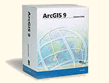
ArcGIS
is an integrated collection of GIS software products for building
a complete GIS for your organization. The ArcGIS framework enables
you to deploy GIS functionality and business logic wherever it is
needed—in desktops, servers (including the Web), or mobile
devices. This architecture, coupled with the geodatabase, gives
you the tools to assemble intelligent geographic information systems.
|
|||
| Desktop
GIS |
More GIS Software | ||
Business Technology |
|||
Server GIS |
Developer Technology |
||
| Desktop GIS | |||
Embedded GIS |
|||
Mobile GIS |
GIS Viewers | ||
 |
ESRI
Corporate Facts |
For more than 30 years, ESRI has been the world's leading provider of geographic information system (GIS) software, according to computer industry analysts at Daratech, Inc. of Cambridge, Massachusetts. ESRI is the dominant company in the over $1 billion worldwide GIS software market.
In 1998, Software Magazine rated ESRI 48th in its annual Software 500 ranking of the world's largest providers of enterprise software.
ESRI has almost 2,000 employees worldwide, of which 1,375 are in the United States at the Redlands, California, headquarters and 9 regional offices. ESRI has a network of 15 international offices and distributors in more than 189 countries to serve our global user base.
Client
List
ESRI technology is used by more than 220,000 clients worldwide, including
most federal agencies, national mapping agencies, 45 of the top 50 petroleum
companies, most forestry companies, and many others in dozens of industries.
Our software is the de facto standard for managing geographic information
in local government and is used by more than 1,500 cities, including Paris,
Bogota, Los Angeles, Beijing, and Kuwait.
Other clients include Sears, Airborne Express, Shell Oil, Korea Telecom, Levi Strauss and Company, Ernst & Young, Occidental Petroleum, Kohler, Chubb Insurance, Time/Warner Cable, GTE, Pacific Gas & Electric, Lockheed-Martin, Chevron, Tenneco, Union Pacific, Conrail, The Nature Conservancy, the National Park Service, the United States Environmental Protection Agency, the U.S. Geological Survey, the Federal Emergency Management Agency, U.S. Forest Service, and NASA. Visit our Industry Web pages to learn more about how our software is used in different industries.
Strategic
Partners
ESRI works closely with major technology partners such as SAP, Microsoft,
Seagate, Informix, Filenet, Sun Microsystems, Compaq, Dell Computer Corporation,
Data General Corporation, Hewlett-Packard, IBM, Oracle, and others to
maintain product compatibility and develop emerging technologies. We also
partner with large data providers like EOSAT, SPOT Image, Equifax/National
Decision Systems, and Geographic Data Technology to bring GIS technology
to new markets.
ESRI also maintains business relationships with more than 700 outstanding developers and value-added software resellers who create new applications and combine our technology with their data, hardware, and consulting services.
3134 Coral Way, Suite B, Miami, FL 33145
Tel: (305) 665-8303 Fax: (786) 552-6359 - E-mail:info@idasnet.com
